A little local knowledge from The Silo
From your door
to the open fields.
Explore the farmland, walk to UMass, or discover Amherst’s trails.
Open skies · Farmland · Sunset walks
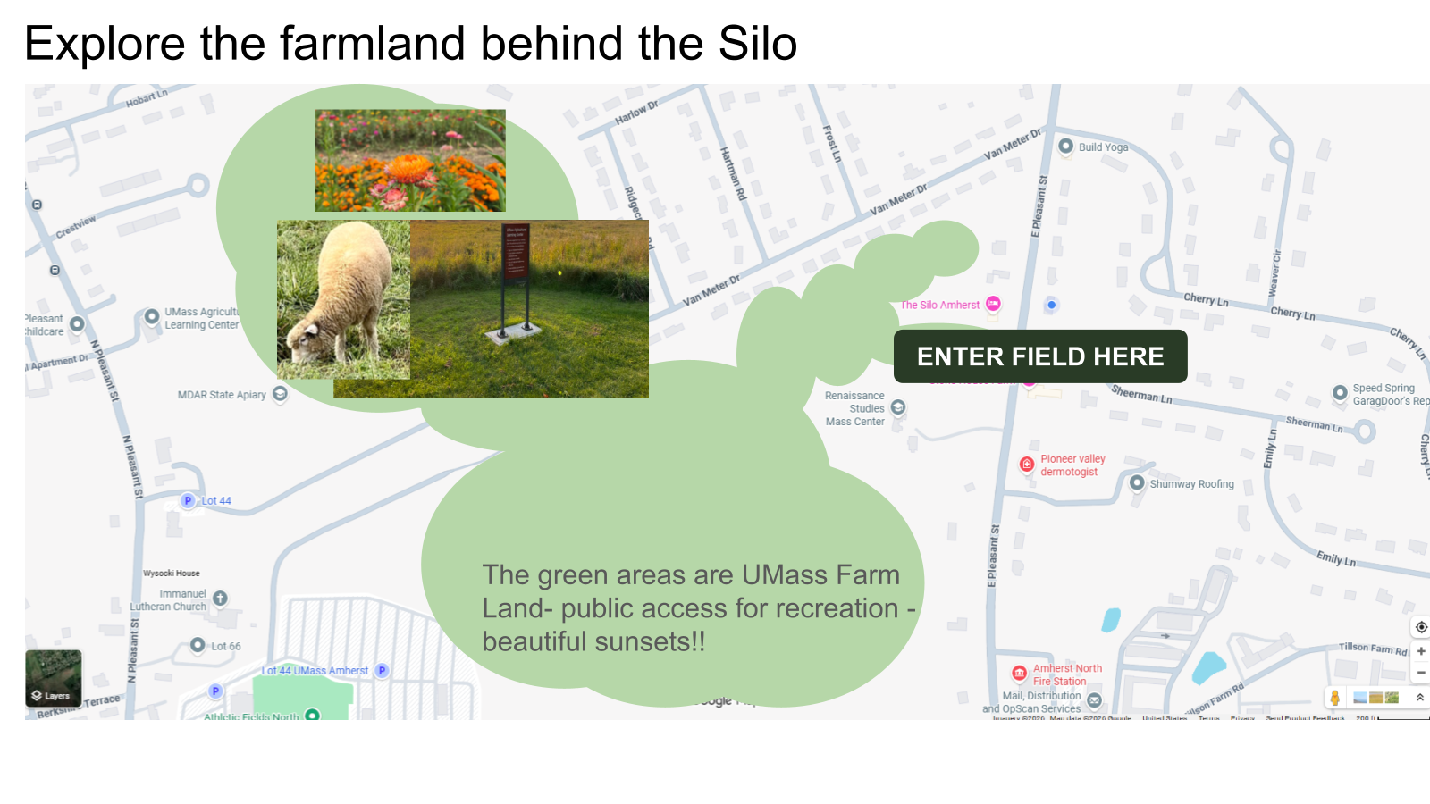
Explore the farmland behind the Silo
Turn right out of The Silo’s driveway and walk about 15 steps. You’ll see the opening into the field.
The green areas on the host’s map show UMass farmland used for recreation and sunset walks.
 THE SILO · START HERE
Enlarge, then scroll across the map to read the details.
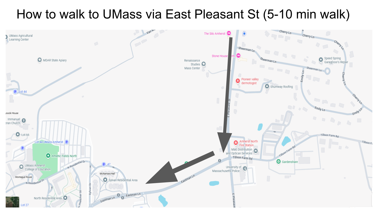
A direct route to campus
Follow East Pleasant Street
- Head south along East Pleasant Street from The Silo.
- Turn right onto Eastman Lane and continue toward campus, following the arrows on the map.
 THE SILO · START HERE
Enlarge, then scroll across the map to read the details.
Campus at a glance
Find The Silo on the campus map
The Silo, marked in the upper-right corner, directly abuts UMass agricultural land and is approximately a 10-minute walk from the heart of campus.
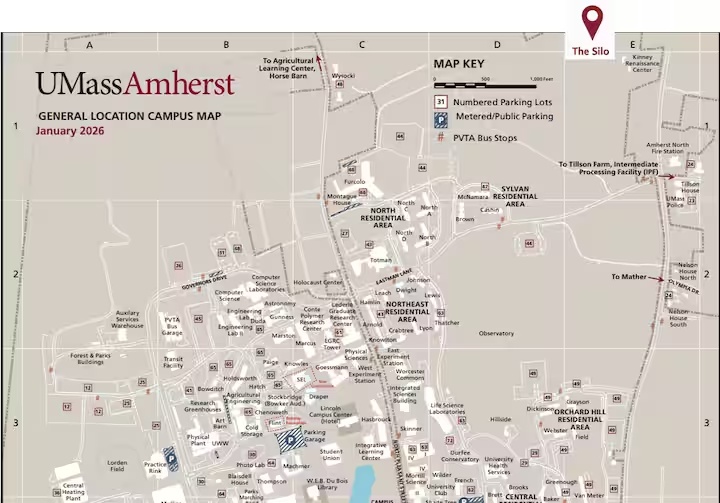
Map: UMass Amherst. Silo location marker added by your host; the original PDF includes the building index.
Woodland paths · Conservation areas · Literary trails
Amherst trails & literary walks
Let your next walk tell a story.
Open the Legend to explore hiking and biking routes, plus the Amherst Literary Trail.
Walking times are approximate. Maps and route notes provided by your host; follow posted signs and current path conditions.